Please use this identifier to cite or link to this item:
http://elar.tsatu.edu.ua/handle/123456789/11921Full metadata record
| DC Field | Value | Language |
|---|---|---|
| dc.contributor.author | Даценко, Людмила Миколаївна | - |
| dc.contributor.author | Даценко, Людмила Николаевна | - |
| dc.contributor.author | Datsenko, Liudmyla | - |
| dc.contributor.author | Ганчук, Максим Миколайович | - |
| dc.contributor.author | Ганчук, Максим Николаевич | - |
| dc.contributor.author | Hanchuk, Maksym | - |
| dc.contributor.author | Токар, Наталія | - |
| dc.date.accessioned | 2020-09-17T08:22:22Z | - |
| dc.date.available | 2020-09-17T08:22:22Z | - |
| dc.date.issued | 2020 | - |
| dc.identifier.uri | http://elar.tsatu.edu.ua/handle/123456789/11921 | - |
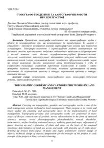
| dc.description.abstract | UK: Проведення топографо-геодезичних та картографічних робіт є однією із землевпорядних дій, що включаються до землеустрою. Їх метою є створення і своєчасне поновлення планово-картографічної основи при здійсненні землеустрою. Топографо-геодезичні і картографічні роботи виконуються на багатьох стадіях проектування: побудова геодезичного знімального обґрунтування у вигляді типових схем; зйомки: аерофототопографічні фототеодолітні, мензульні, теодолітні, тахеометричні, нівелю-вання поверхні, кадастрові зйомки; оновлення планів і карт; корегування планів; складання і оформ-лення планів і карт на основі виконаних зйомок; визначення площ землекористувань і угідь зі складанням експлікації; складання проектних планів-копій із планів і карт; попереднє (ескізне) проектування об’єктів; технічне проектування об’єктів; підготовка до перенесення проекту в натуру; перенесення проекту в натуру; виконавчі зйомки. EN: Carrying out topographic, geodetic and cartographic works is one of the land management actions included in land management. Their purpose is to create and timely update the planning and cartographic basis in the implementation of land management. Topographic-geodetic and cartographic works are performed at many stages of design: construction of geodetic survey substantiation in the form of standard schemes; surveys: aerial phototopographic phototheodolite, menzul, theodolite, tacheometric, surface leveling, cadastral surveys; updating plans and maps; adjustment of plans; drawing up and registration of plans and maps on the basis of the executed shootings; determination of land use areas and lands with drawing up of explication; drawing up project plans-copies of plans and maps; preliminary (sketch) design of objects; technical design of objects; preparation for the transfer of the project in kind; transfer of the project in kind; executive shooting. | uk |
| dc.language.iso | uk | uk |
| dc.relation.ispartofseries | Матеріали ХІ-ої науково-практичної конференції «Меліорація та водовикористання. Технології та еколого-економічні рішення в сучасних умовах господарювання»;(С. 53-57) | - |
| dc.subject | землеустрій | uk |
| dc.subject | картографічні роботи | uk |
| dc.subject | топографічний план | uk |
| dc.subject | топографо-геодезичні роботи | uk |
| dc.subject | land management | uk |
| dc.subject | cartographic works | uk |
| dc.subject | topographic plan | uk |
| dc.subject | topographic and geodetic works | uk |
| dc.title | Топографо-геодезичні та картографічні роботи при землеустрої | uk |
| dc.title.alternative | Topographic-geodesic and cartographic works in land management | uk |
| dc.type | Article | uk |
| Appears in Collections: | Кафедра Геоекологія та землеустрій | |
Files in This Item:
| File | Description | Size | Format | |
|---|---|---|---|---|
| Матеріали конф. МЕЛІОРАЦІЯ 08.07.2020-53-57.pdf | 336.92 kB | Adobe PDF |  View/Open |
Show simple item record
CORE Recommender
???jsp.display-item.check???
Items in DSpace are protected by copyright, with all rights reserved, unless otherwise indicated.
